GeoView Pro is a geospatial data viewing & data collection application designed for professionals, scientists and just about anyone who uses a map. Use it to create a layered display of base maps, gridded data with interactive shadowing, vector graphics and your current GPS position. You choose the files, we sort out the details.
For our other applications called GeoView Lite click here and GeoView Cache click here
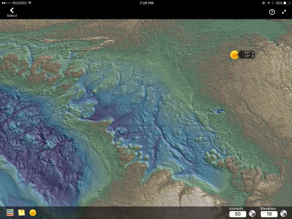
Earth surface and bathymetry data in and around Georgian Bay, Canada presented in false colour with shadow enhancement.

Ocean level data overlaid on a base map. When multiple objects are selected in close proximity, a pick list is presented.
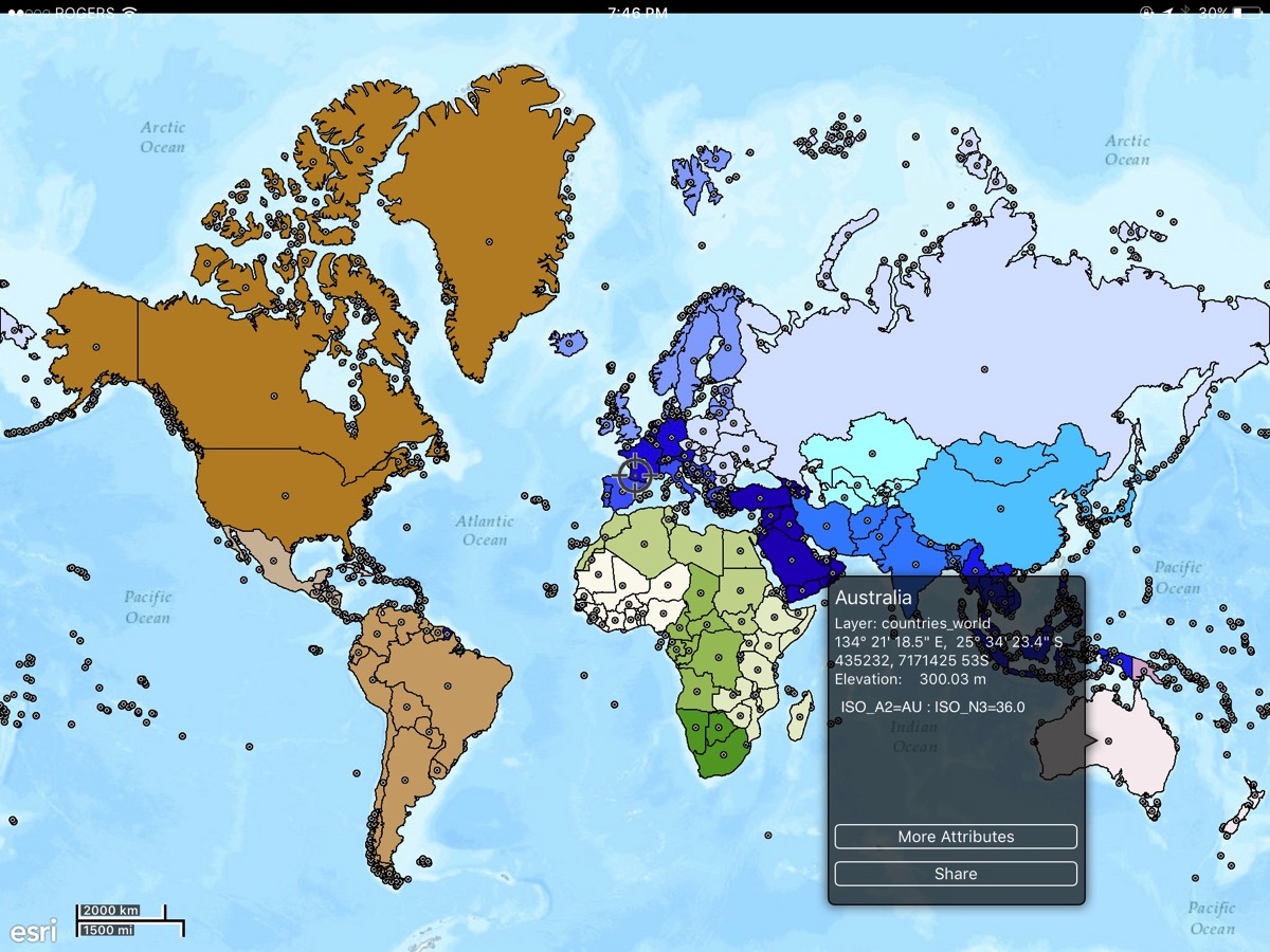
A vector based world map with Australia selected. The view is full-screen (top and bottom menu bars hidden) to maximize the map viewing area.
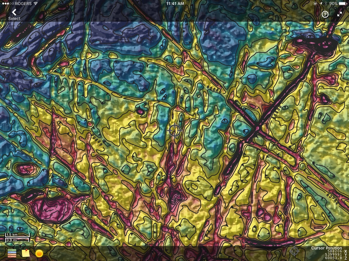
Magnetic geophysical gridded data (cold to hot - low to high; false colour scale) overlaid with contour vectors and shadowed with an artificial sun direction to enhance the Z data.

Geology in a KML file overlaid on a Mapbox base map.
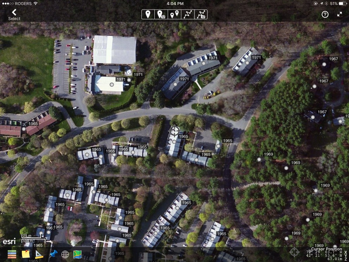
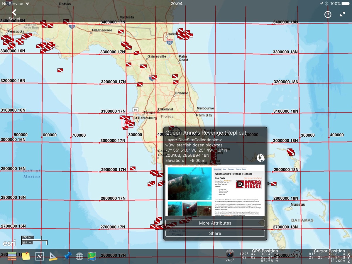
Satellite imagery overlaid with date-of-construction KML placemark data.
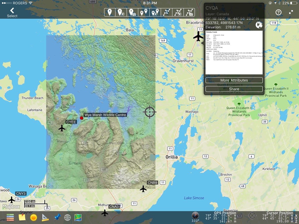
A powerful feature of GeoView Pro is the ability to layer map data. A Mapbox map has been overlaid with DEM (digital elevation model) gridded data and enhanced with shadowing to accentuate the relief. A KMZ file of airports and markup of a local tourist attraction has been added to demonstrate vector overlays. Note that the airport KML has embedded website links and a preview of information available for airport CYQA is being shown.
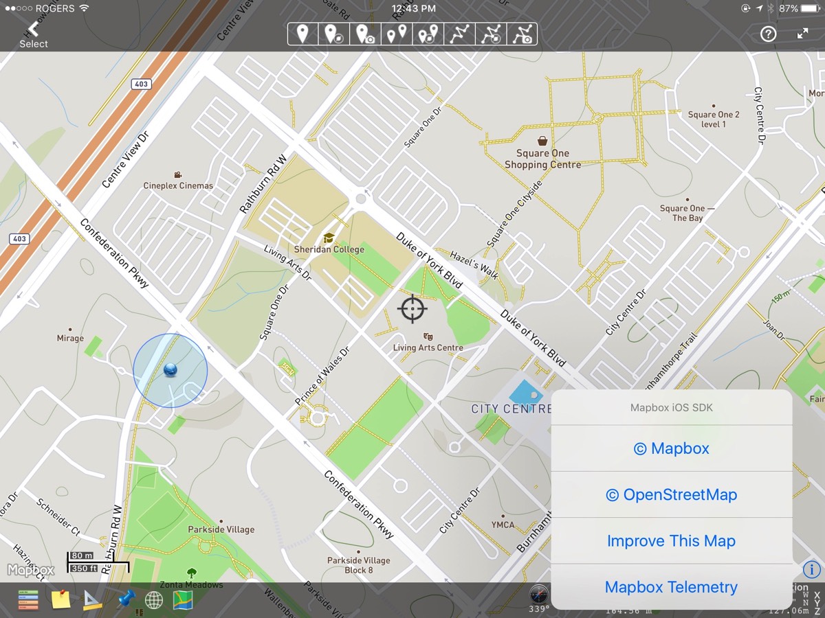
Submit corrections to OpenStreetMap™ when using Mapbox™ as your basemap.
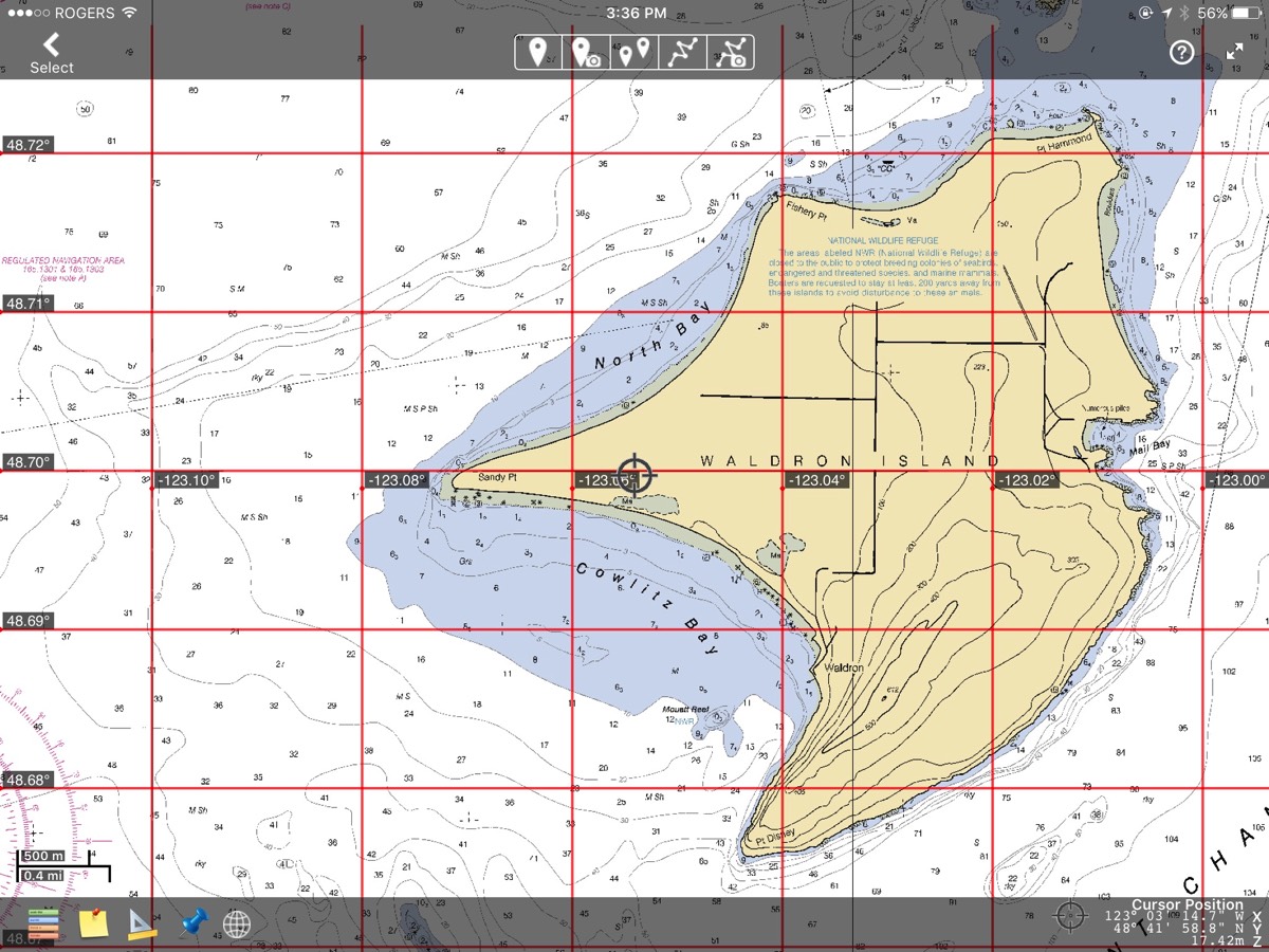
A BSB Nautical map with a geographic reference grid created by GeoView Pro.
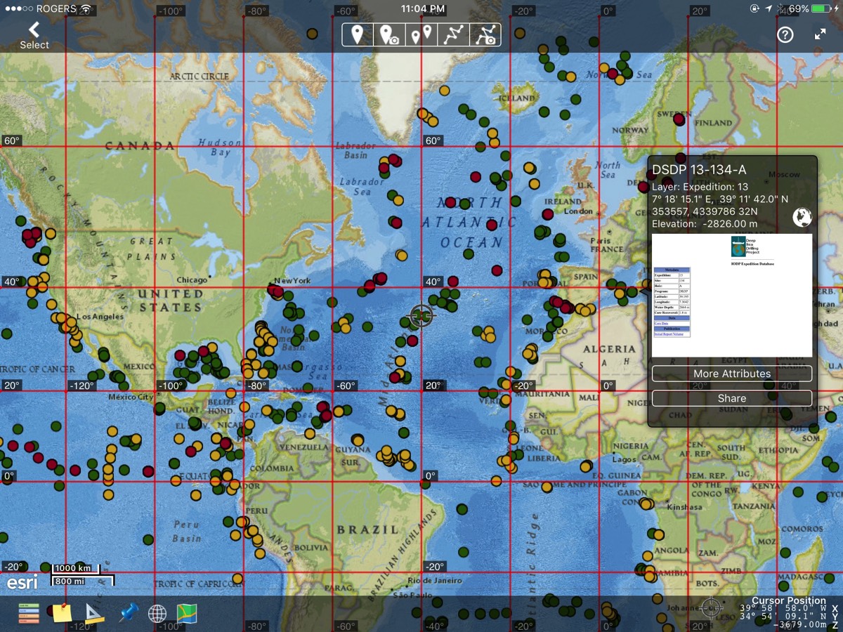
Sub-seafloor drill-hole information compiled by the IODP (International Ocean Discovery Program). Each placemark contains Internet accessible web data which can be viewed by clicking the globe icon on the pop-up.
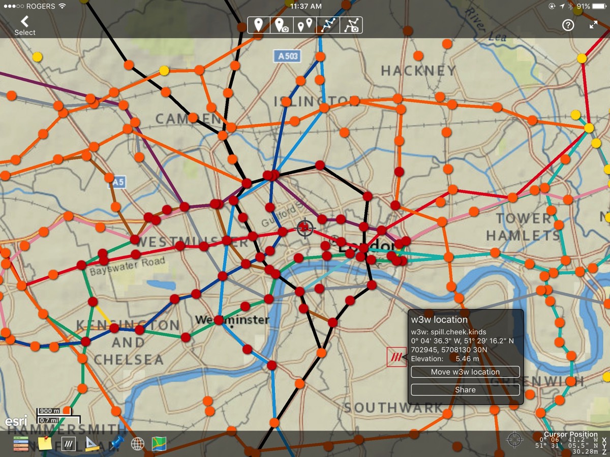
A KML map of the London Underground showing routes and stations. The basemap is an Esri web map.
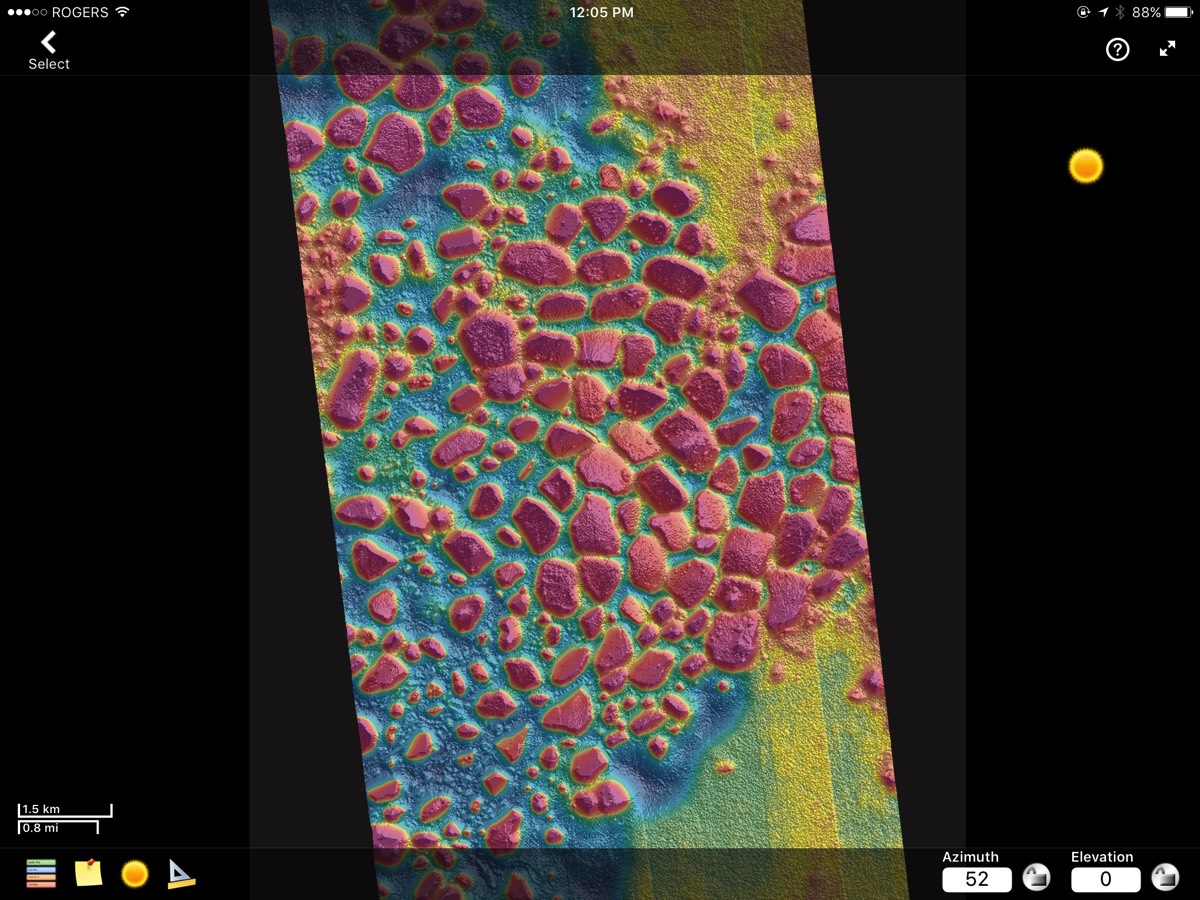
Mesa and Buttes on Mars represented in false colour and shadowed to enhance the relief.
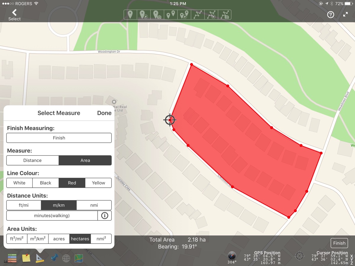
Using measurement tools to find the area of a subdivision. Measurement tools can use imperial or metric measures or custom distance units ( defined by you ).
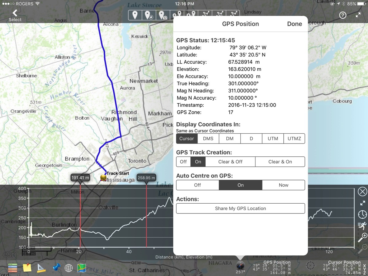
You can track and record your GPS position in realtime and display the coordinates in Lat-Long or UTM values. The track is updated on your chosen base-map in real-time.
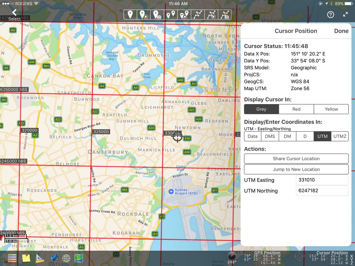
Your cursor position can be displayed in units independently chosen from the GPS or reference grid. If you need to find a location quickly, you can jump to the new location by entering the coordinates in the most convenient format.

On any display having valid world coordinates, you may add markup (routes, placemarks). Each place-mark or route-mark may have a custom symbol, description, location and media attachment ( audios, videos, photos ).
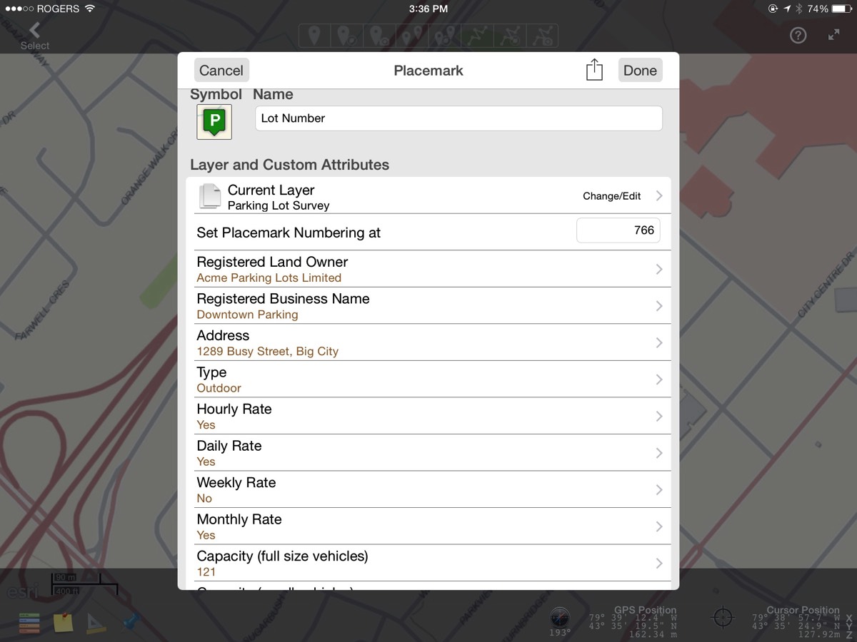
In addition to the default markup attributes, you may customize your place-mark data to include your own attributes and customize an input form for quicker data entry.
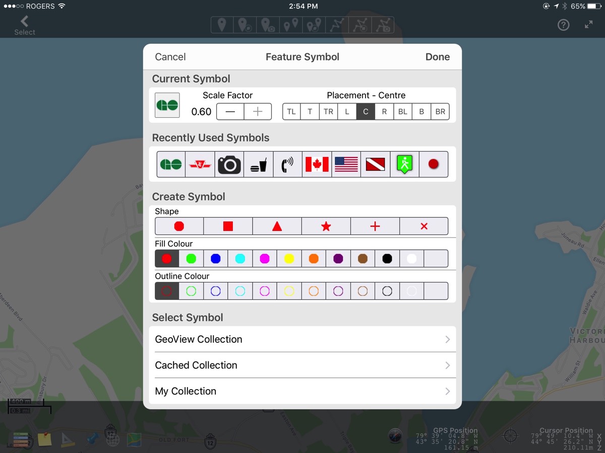
All features may have an symbol assigned. Three different symbol collections are maintained. The GeoView Collection is a small set of simple symbols to get you started. Any KML files that you view will have their symbols cached so you may reuse them later. Also, you can build your own collection of symbols from various Internet sources. We cache all symbols so they will be visible when the Internet is unavailable to you.

If you are working in a area where the Internet coverage is poor or unavailable, you may use your own base maps along with your data.
Static base maps (no zooming) for Canada and the United States can be downloaded directly from within GeoView Pro. For even more flexibility, you can download tiled base maps (with multiple zoom levels) from various mapping agencies. You may need to set up an account with some agencies to access this feature.
Static base maps (no zooming) for Canada and the United States can be downloaded directly from within GeoView Pro. For even more flexibility, you can download tiled base maps (with multiple zoom levels) from various mapping agencies. You may need to set up an account with some agencies to access this feature.
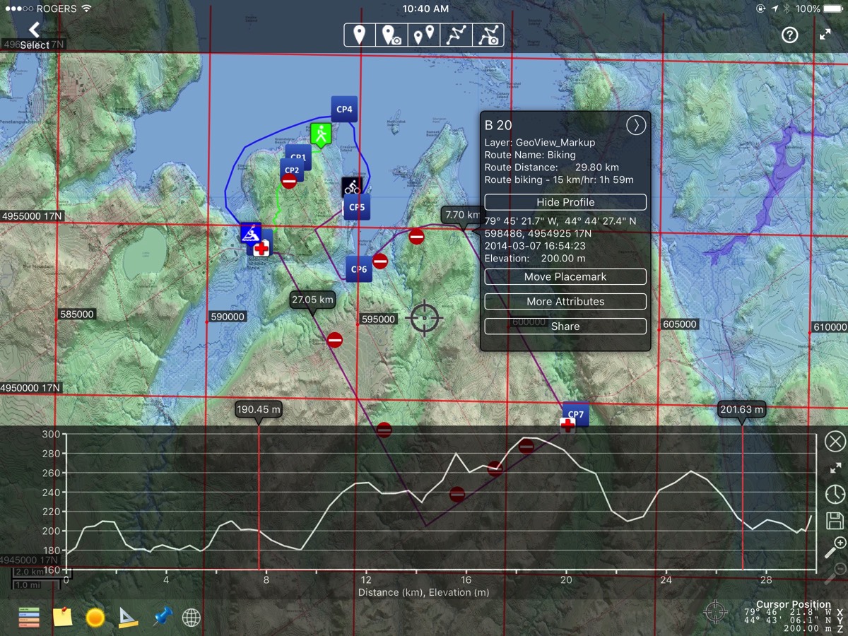
Any route or track may be profiled at a high resolution. The elevation data is fetched from an Internet service if it is not available in the file.
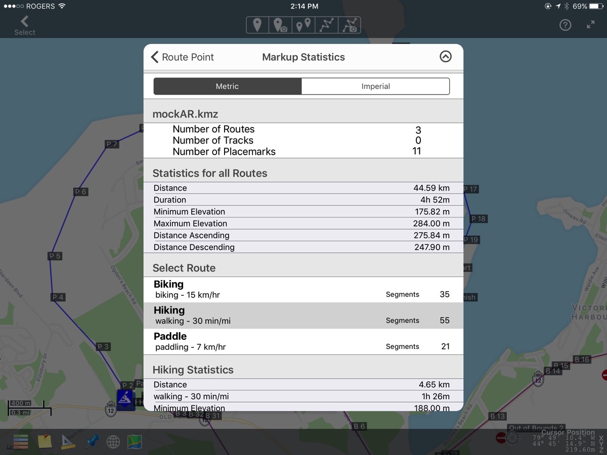
To complement route and track profiles, numerical statistics are maintained.
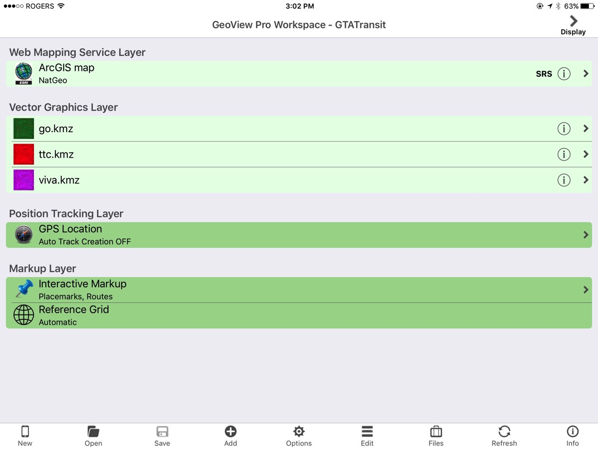
On the select screen, you can choose the data you wish to view, customize layer display order, change default colours, manage local files and change program options and settings.

Markup & profiles, cursor location, and GPS location are all share-able.
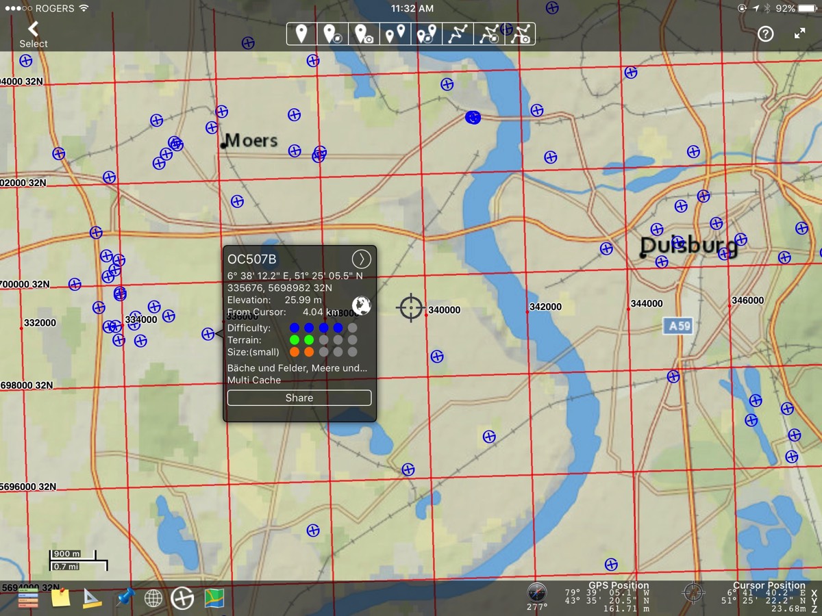
Because life isn't all about work, we have included a geocaching layer. While you are on your lunch break, you might just want to get that cache thats nearby.
The Internet is a treasure trove of KML data. If you have a need or an interest and it can be mapped; there is likely KML data out there for you.
FEATURES in Version 5.2
- Internet base maps available from Apple™, ArcGIS™, or Mapbox™
- overlay Internet or file base maps with raster data, gridded data, interactive shadow, vector data
- overlay information from Internet data sources
- overlay your current GPS position
- download maps for offline use within GeoView Pro
- reprojection of vector data and GPS to your geo-referenced base maps
- add, edit & save placemarks, GPS tracks and routes with user-selectable symbols, names & descriptions
- define, collect and display custom attribute data organized into KML layers
- attach multiple media files (photos, video clips, audio clips) to placemarks
- post your placemarks, routes, & GPS track on popular social media
- supports many popular file formats (with more being added all the time)
- “addressing the world using what3words
Requirements: Compatible with iPad, iPad mini & iPhone running IOS 9 or later. An active Internet connection is required to use Apple™ maps, ArcGIS™ maps, Mapbox™ maps, real-time elevation data, geocaching databases & what3words. An iPad with "Wifi + Cellular" is required for GPS functionality. Offline maps may require you to set up an account with the mapping agency.
We are continually adding new features and file support. Watch for announcements on Twitter.
- from Wikipedia…
"A world file is a six line plain text sidecar file used by geographic information systems (GIS) to georeference raster map images." - URL based symbols are graphics files that are directly accessible using a uniform resource locator. The symbol at canada.png is described by the URL:
http://symbols.geoviewpro.com/SymbolLibrary/WorldFlags/canada.png
Visit http://symbols.geoviewpro.com to find symbols that you can use with GeoView Pro & GeoView Lite. - In cases where you have been using webmaps but will working someplace where the Internet is unavailable you may download static or tiled maps for offline use. Static maps (no zoom) are available for Canada and United States only. Tiled maps (with multiple zoom levels) are available for locations world-wide. Both are only usable within GeoView Pro. Tiled map downloads may require you to register with the provider.
-
- estimate route completion times using named custom speeds
- automatic layer sorting, logical default display parameters, dynamic scale-bar
- display a reference grid in Lat-long or UTMs
- import features, layers and attributes from supported vector graphics file types
- file management and distribution using Dropbox, iCloud, AirDrop, and HTTP
- downloaded maps are available without Internet connectivity
- geo-referencing using embedded data, World Files, or manual entry
- create your own collection of URL based symbols for use with markup
- display elevation profiles of routes and tracks
- Lorem ipsum dolor sit amet, sapien platea morbi dolor lacus nunc, nunc ullamcorper. Felis aliquet egestas vitae, nibh ante quis quis dolor sed mauris. Erat lectus sem ut lobortis, adipiscing ligula eleifend, sodales fringilla mattis dui nullam. Ac massa aliquet.
- Lorem ipsum dolor sit amet, sapien platea morbi dolor lacus nunc, nunc ullamcorper. Felis aliquet egestas vitae, nibh ante quis quis dolor sed mauris. Erat lectus sem ut lobortis, adipiscing ligula eleifend, sodales fringilla mattis dui nullam. Ac massa aliquet.


